How monitoring systems can help protect communities from wildfires.
As wildfires threaten communities around the world, monitoring systems using Big Data are helping firefighters, government agencies and humanitarian organizations proactively take steps to save lives.
ITU plays an essential role in using information communication technologies (ICTs) for disaster risk reduction and management by designing national emergency telecommunication plans, setting up early warning and monitoring systems, and providing emergency telecommunications equipment when disasters strike.
‘Early Warning and Alert Systems are critical components of emergency telecommunications to reduce the vulnerability of communities at risk and save lives.’ – Brahima Sanou, Director, ITU’s Telecommunication Development Bureau
Applying ICTs to wildfire disaster risk reduction is especially important in light of the large number of fires this summer. Greece recently experienced its worst wildfire in a decade, California has been facing record-breaking fires, and wildfires have been sweeping across the U.K.
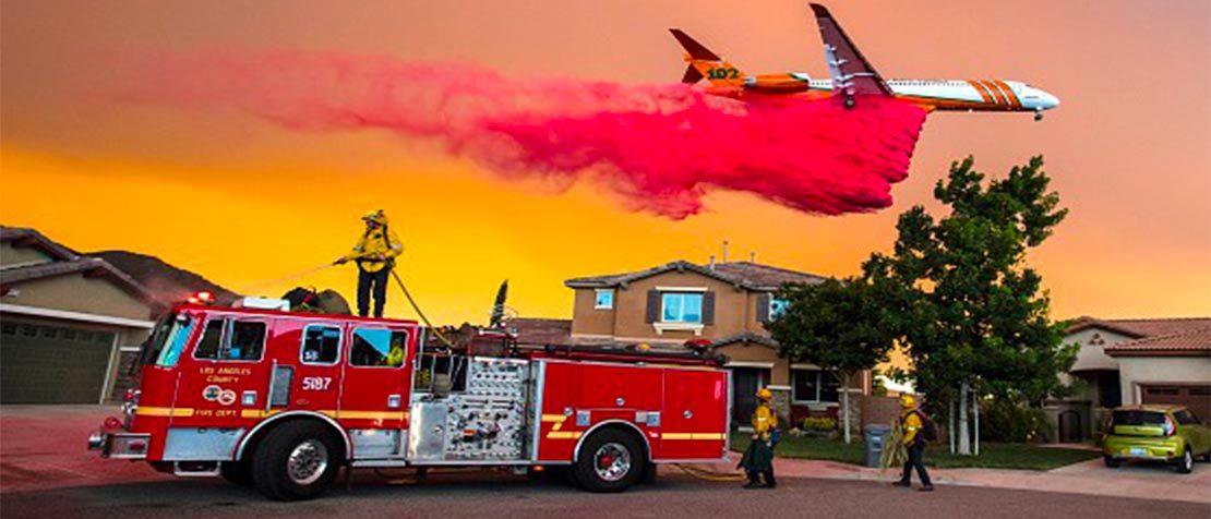
Forecasting wildfires with Big Data
In California, WIFIRE offers an integrated system that combines historic trends with real-time data, including information from satellites, weather stations and sensors, to forecast where wildfires are heading. The system uses high-speed communication networks and advanced computing to create a visual model that first responders can use to fight fires and help those in their path.
“Fires are happening more frequently and larger than ever, and they’re not going to stop,” says Ilkay Altintas, Chief Data Science Officer at the San Diego Supercomputer Center and Principle Investigator for WIFIRE.
Collecting, analysing and applying data about wildfires can help reduce risks by answering questions about where wildfires are and where they are most likely to go next, Altintas says. WIFIRE tracks data including images of the fire, air quality, and weather forecast information to create behavior models of the fire.
“We have a better-than-ever ability to measure our environment and Earth,” she says. “The data is becoming ready to be used within these fire scenarios.”
In Europe, EnviroSAR, a U.K.-based project, uses radar and other satellite technology to mitigate wildfire risks and support the planning and execution of land restoration activities. Satellite images supplied by the European Space Agency (ESA) provide essential data on the size, burn severity and long-term post-fire effects in terms of vegetation recovery and peat erosion rates, according to Dr Gail Millin-Chalabi, Director and Technical Lead of EnviroSAR.
“Using satellite technology can potentially save organizations such as utility companies, conservation agencies and other land owners time and money by extracting this critical information remotely rather than sending out field teams to collect the data using handheld GPS,” she says.
Access to information
In addition to providing key information to emergency response teams, these systems can help educate the public about fire risks. Using ICTs to share information about fires and spread best practices can help keep people safe.
“Largely the world doesn’t understand how fire works and what it means to be in danger,” says Jessica Block, Spatial Data Scientist and Project Coordinator for WIFIRE. “We’re trying to democratize the access to understanding fire behaviour and being able to communicate that hazard to the public.”
ITU’s role in disaster risk reduction
ITU partnered with the Zambia Information and Communication Telecommunication Authority (ZICTA) in December 2017 to install flood early warning systems in Kasaya village that alert local residents of floods, saving lives and providing governments and humanitarian agencies with information about where relief efforts are needed (see video).
During Hurricane Irma last year, ITU deployed satellite phones and broadband satellite terminals to the region, helping ensure the timely flow of vital information to government agencies and humanitarian organizations involved in rescue operations.
“Early Warning and Alert Systems are critical components of emergency telecommunications to reduce the vulnerability of communities at risk and save lives,” says Brahima Sanou, Director of ITU’s Telecommunication Development Bureau.
Moving forward
An increasing number of information sources, including from Internet of Things technologies such as wireless sensors and cameras, can help improve wildfire monitoring systems in the future, Millin-Chalabi says.
“Cameras and weather stations can be used for areas identified as high risk which can help greatly with targeting fire-fighting resources,” adds Millin-Chalabi.
As the technologies evolve, fully integrated monitoring and prediction systems can help emergency responders improve planning for all types of natural disasters, Altintas says.
“If we start looking at this issue as a system of systems – what are the interactions between these various processes and the dynamics between them and how we can build planning scenarios for resilience to any disaster – that will be the future,” concludes Altintas.
By Kirsten Salyer @kirstensalyer