How tech is helping to map refugees in times of crisis
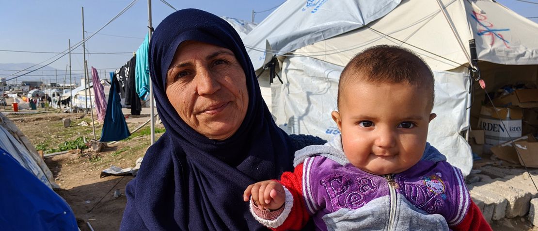
On a bright sunny day in May, the muddy streets of Bardarash camp in northern Iraq are unusually quiet. The typically busy and hectic market – overflowing with fresh fruit and fish warmed by the day’s sun – is on lockdown. A case of COVID-19 has been identified in the camp.
Walking among the sea of white tents, Sozan Fahmi, Iraq Coordinator at Khalsa Aid, quickly distributes ‘Coronavirus Emergency Relief’ packs, filled to the brim with staples including bread, rice, disinfectant and cleaning wipes, to the camps’ 20,000+ residents.
But these are some of the lucky ones. “For people away from camps, the situation is worse,” Fahmi said. “People don’t have food in the house.”
There are 29.6 million refugees around the world – but only 2.6 million live in camps, according to UNHCR, the United Nations Refugee Agency. The rest live in urban areas and informal camps, which can offer a more normal life for people forced to flee their homes amid violence or the threat of persecution.
As COVID-19 continues to spread across the world, it has exacerbated the already dire humanitarian needs, and UNHCR warns that urgent action is required to help the most vulnerable refugees and internally displaced persons, especially where they have no access to state-run social protection schemes.
But as one global crisis feeds into another, in order to share information about keeping safe during the COVID-19 pandemic and provide emergency support to refugees, aid agencies first need to know where they are.
Mapping refugees in Lebanon
Lebanon is home to one of the largest refugee populations in the world, with close to two million people spread across the country in both formal camps and informal places of residence.
In 2013, the Switzerland-based non-governmental organization Medair launched the Inter-Agency Mapping Platform (IAMP) project to identify and map refugees living in informal settlements (IS) across Lebanon after it became clear that refugees were not receiving assistance because their locations and existence were not known.
“In collaboration with UNHCR and supported by ECHO [the European Civilian Protection and Humanitarian Aid Operations], we introduced a Place-code (PCode) system that provides a unique identifier – somewhat like an ‘address’ – to each IS based on Governorate, District and Cadastre,” Paola Barioli, Senior Communications and Media Relations Officer at Medair, told ITU News. “PCodes provide a quick and accurate reference that all agencies and people living in ISs understand, and allows each IS to be counted, referenced, located and therefore served with humanitarian aid.”
MedAir uses a range of geographic information system software, web GIS and geodatabase management applications to share data with relevant mapping partners. They also develop data visualisation maps and analytical products to highlight trends, population movement, and changes in the profile of informal settlements.
The map is now helping relevant refugee organizations in Lebanon coordinate COVID-19 relief efforts, increasing the efficiency and effectiveness of the response. “Recording the response’s events and reporting the data will help monitor the situation and make better decisions,” said Barioli.
Mapping refugees worldwide
Techfugees, a global community that develops and coordinates technology-enabled solutions to support refugees worldwide, has launched an open-sourced platform to map the impact of COVID-19 on displaced communities – as well as existing solutions that could assist the global response to the coronavirus crisis.
“Refugees are found everywhere on this planet, but with different situations, depending on where they live their rights in that country,” Joséphine Goube, CEO of Techfugees told ITU News. “We wanted to be able to give people data points to make informed decisions.”
The volunteer-built interactive platform gathers data from multiple sources – from on-the-ground direct reports and refugee surveys, to online media and social media monitoring – on how COVID-19 is affecting refugees from a health, human rights and socio-economic standpoint.
It provides NGOs, civil society and innovators with real-time on-the-ground updates to help direct assistance to those in need.
For Goube, the map takes on significant importance beyond the global pandemic. “More people will die of hunger and economic catastrophes, like the lack of funding to Africa, than the Coronavirus, therefore it is important that we record that evidence” she said.
Image copyright: Lucy Spencer