WRS-22: Trends in maritime communications
By ITU News
An estimated 90 per cent of the goods traded around the world travel by sea. Vital commodity flows, as well as seafarer safety, hinge on ever more sophisticated maritime communication networks.
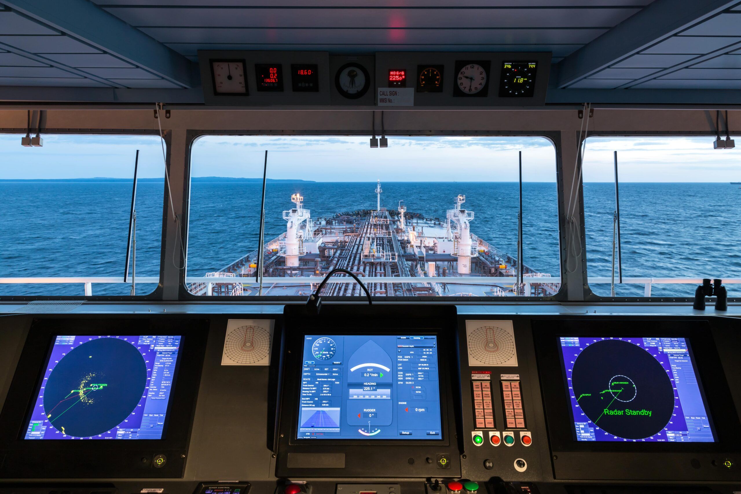
Much of the world’s commerce would simply not be possible without the plethora of technologies making up today’s maritime communications ecosystem. These include ship stations (meaning radiocommunication equipment on board commercial, passenger or patrol vessels, etc.); coast stations that support ships at sea; as well as radar services, automatic identification, and maritime distress systems.
Search and rescue aircraft also form part of this ecosystem of global maritime safety resources. All these systems rely on some form of radiocommunication. By extension, they utilize the naturally limited radio frequency spectrum.
Although the International Maritime Organization (IMO) develops regulations for shipping, ensuring safe maritime communication largely falls to the International Telecommunication Union (ITU).
ITU Recommendations, Reports, Regulations, and databases – along with giving seafarers vital information – help safeguard the frequency bands that vessels use to navigate safely, as explained by ITU’s German Medici at the World Radiocommunication Seminar (WRS-22) in October.
Modernizing the GMDSS
Distress, safety, and emergency maritime communications are coordinated through the Global Maritime Distress and Safety System (GMDSS), which uses terrestrial communication and satellite systems (such as those operated by Inmarsat and Iridium) to connect ships and coast stations. Discussions currently underway at ITU aim to make the GMDSS more flexible in terms of maritime safety information distribution, which in turn should open the door to new technology applications in this area, said Medici.
Digital selective calling (DSC), for example, which enables a radio station to establish contact with and transfer information to another station or group of stations, enhances maritime safety. Similarly, new configurations in the Cospas-Sarsat Satellite Programme will improve the reception of distress alerts from Emergency Position-Indicating Radio Beacons (EPIRBs).
The GMDSS continues to evolve to improve and enhance maritime communications and safety. Satellite EPIRBs operating at 1.6 gigahertz (GHz) and using very high frequency (VHF) systems for DSC will no longer be part of the GMDSS. However, the IMO may soon allow an existing geostationary satellite system to become a new GMDSS satellite service provider, explained Medici.
Evolving e-navigation
In the future, seafarers will increasingly rely on communications services, such as e-navigation, which IMO defines as “the harmonized collection, integration, exchange, presentation and analysis of marine information on board and ashore by electronic means to enhance berth-to-berth navigation and related services for safety and security at sea and to protect the marine environment”. High-speed broadband connections will keep ships and shore facilities continuously updated and let mariners follow real-time data displays on the bridge.
Voice digitalization through VHF radio technology could further enhance e-navigation.
Ships will increasingly use VHF data exchange systems that integrate data exchange, application-specific messaging, and automatic identification capabilities in the same VHF maritime band, Medici added.
Beacon detection and response
Cospas-Sarsat, a satellite-aided, treaty-based search and rescue initiative that has been operational since 1985, is now developing a second-generation beacon and medium-Earth orbit search and rescue system (MEOSAR), in which repeaters are placed on global navigation satellite system (GNSS) satellites.
The initiative brings together 45 nations and agencies to collaboratively detect and locate radio beacons activated by aircraft, vessels or people in distress.

This Cospas-Sarsat development will enable near-time global coverage of beacon localization and distress message transmission, said Medici. A new “return-link-service” (RLS) will give users a confirmation that their message was received.
MEOSAR complements the geostationary search and rescue (GEOSAR) system and will eventually replace the low-Earth orbit (LEOSAR) system.
Autonomous vessels on the waves
Maritime autonomous surface ships (MASS) are also on the horizon. These are ships that can operate independently (to varying degrees) of human interaction.
“In April 2022, IMO began work on the development of a regulatory framework for Maritime Autonomous Surface Ships,” Medici noted. The work aims to integrate new and advancing technologies in its regulatory framework – balancing the benefits derived from new and advancing technologies against safety and security concerns, the impact on the environment and on international trade facilitation, the potential costs to the industry, and their impact on personnel, both on board and ashore.
For the moment, these “autonomous vessels” lack specified spectrum requirements. But that may change as MASS communications requirements are identified. “The development of MASS may be supported by future ITU studies, including potential determination of their spectrum needs, and the publication of associated ITU Recommendations and Reports,” Medici concluded.
This special ITU News blog series features content from the 30th World Radiocommunication Seminar, including a closer look at the latest trends in broadcasting, international mobile technologies, maritime communications, space and terrestrial services, and more. The series will conclude a preview of the World Radiocommunication Conference (WRC-23), set to take place in Dubai from 20 November to 15 December 2023.
Header image credit: momentscatcher via Adobe Stock