Gybe Maps: The right data for intelligent water management

Satellite imagery combined with ground sensors helps to safeguard clean, drinkable water for everyone. As we explore digital solutions to achieve the Sustainable Development Goals, we share the perspective of Sara De Moitié, Co‑Founder and Chief Product Officer, at Gybe.
Tell us about your digital solution to accelerate progress on the UN Sustainable Development Goals (SDGs).
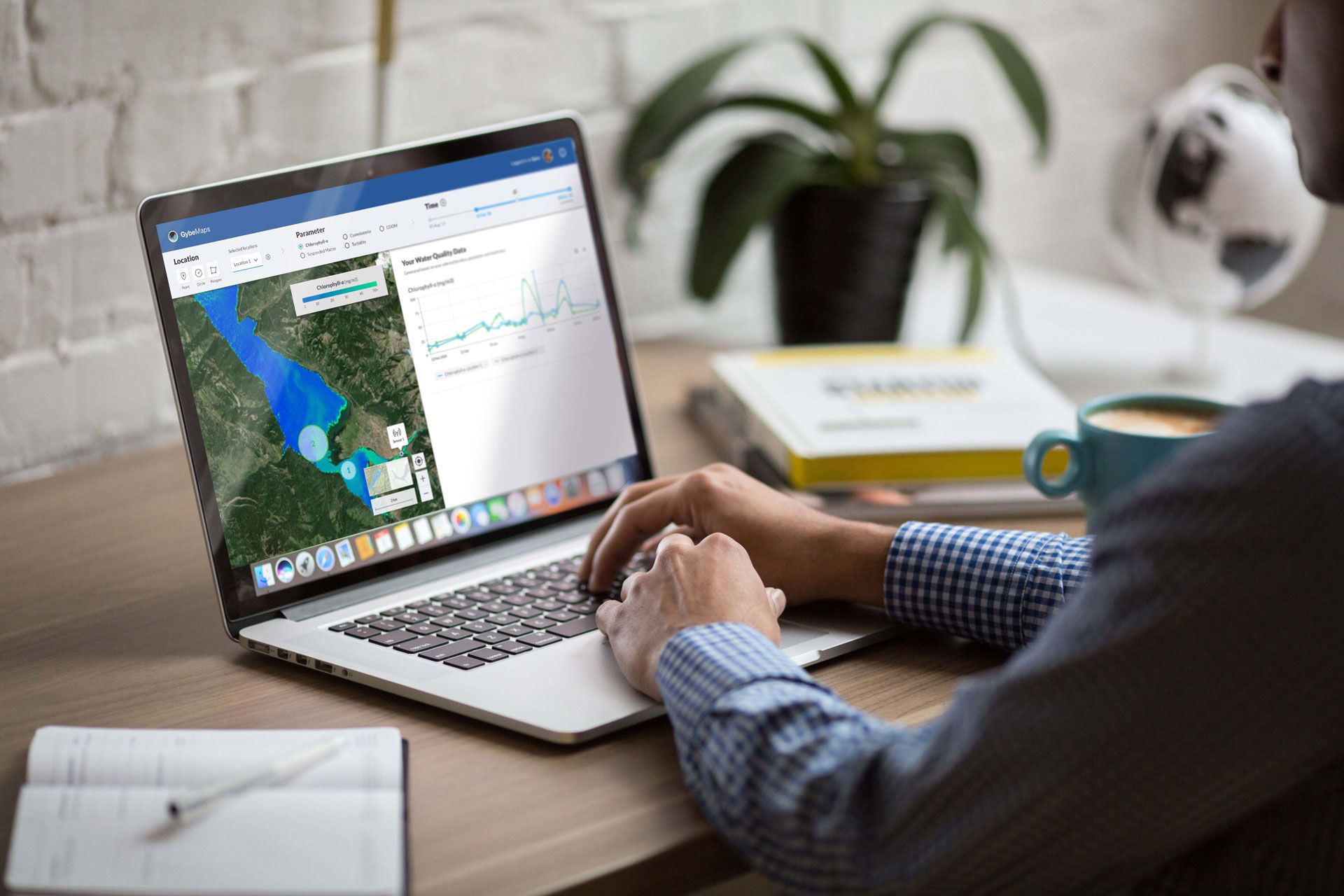
Around the world, water supplies are under pressure. Demand is growing, while variability of environmental conditions increases, lowering water quality. We help governments and NGOs, engineering firms, and utilities better manage, track, monitor and understand how water conditions are changing across water-stressed basins, rivers, lakes and coastal regions.
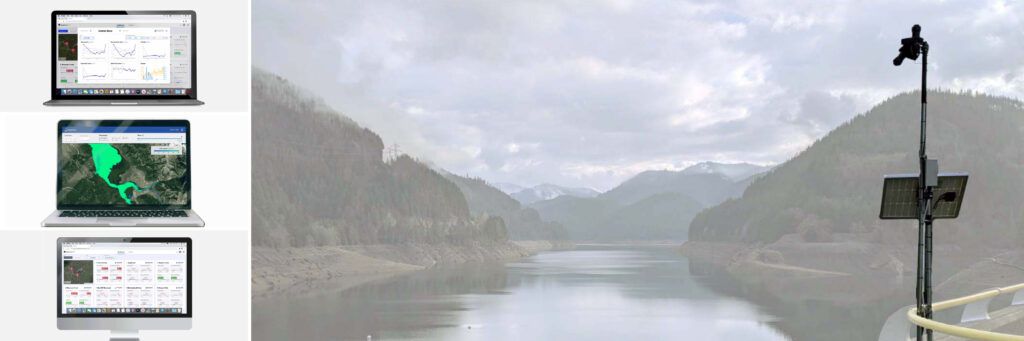
Using satellite imagery and ground sensors, Gybe provides a software solution to monitor what’s happening – now and historically – everywhere. Gybe’s solution is scalable across large regions and complements existing data collections at a fraction of the cost.
Which organization or group is behind this digital solution?
Gybe is a US-based technology company founded in 2019. It consists of a multidisciplinary team of experts.
We combine expertise from five key fields:
- Optical remote sensing – deriving useful information from satellite images;
- Hardware – developing low-cost, low-maintenance, autonomous ground sensors;
- Applied science – developing new, state-of-the-art data products, such as prediction models, and new water metrics;
- Design – providing easy to use, effective solutions;
- Software development – ensuring easy access to the latest information via our web app.
How can your digital solution help put the SDGs back on track?
In terms of current impact, Gybe enables better water management decisions. In the short term, this includes improved water safety, for drinking water and for recreation, and more effective water treatment, with more targeted and timely action, as well as significant cost savings and scalability.
In the long term, we help discover sources of water pollution, track impact, and enable smarter investments in environmental restoration and conservation efforts.
In addition, Gybe’s system is built for scale: adding new areas to monitor is fast and easy. Our vision is to become a source of truth in water systems, helping enable collaboration across diverse stakeholder and user groups.
Which SDGs does your project aim to address, and why?
Gybe clearly supports Goal 6 (clean water and sanitation), as we help guarantee access to healthy drinking water and track stormwater, sewage, agricultural runoff, and other sources of pollution.
But well-informed, smart water management also addresses:
- Goal 2: zero hunger – as freshwater supplies are critical for food production, for both farms and fisheries.
- Goal 3: good health and well-being – by helping to ensure access to healthy drinking water and safe recreational areas.
- Goal 13: climate action – improving climate resilience by tracking drought, flood, and fire impacts on water reserves.
- Goal 14: life below water – improving wildlife habitats and biodiversity by tracking important ecological water metrics.
- Goal 15: life on land – as land ecosystems also require good quality water to thrive.
What are the greatest challenges or risks you have faced in rolling out your digital solution for the SDGs?
Water is hyper local, which is a challenge from a scientific point of view.
Water is complex, so we have built a system that works locally first and is optimized for each place where we monitor. Working from the top down does not work for water, since each location is unique.
Another challenge is defining the most important water-related questions to answer.
Water is relevant to everyone, from industry and governments to the general public. We’ve built our product to focus, initially, on the most important questions about water management, whether for the short-term, like the needs of water utilities, or long-term, such as impact assessments.
What are the advantages of joining forces with ITU, UNDP and other partners to advance digital solutions for the SDGs?
Partnerships are helpful in terms of:
- Priority – ensuring action on key basins of adoption with the highest risk and needs;
- Scalability – bringing solutions to multiple high-risk watersheds and geographies;
- Acceleration – facilitating capacity building, digital adoption, and integration with current management practices;
- Connection – with government bodies, NGOs, and the private sector, enabling continuity of funding for continuous restoration efforts across priority basins and regions;
- Collaboration – between multiple stakeholders and user groups in high-risk areas, to collectively achieve better outcomes for all.
Sara de Moitié, Co-Founder and Chief Product Officer, Gybe Maps, presented this solution to safeguard global water supplies during the SDG Digital event at UN Headquarters on 17 September.
Gybe is featured as a digital solution for SDG6 (clean water and sanitation) in the SDG Digital Acceleration Agenda, prepared by ITU and UNDP with knowledge partner Boston Consulting Group and support from the Inter-American Development Bank (IDB).
Credit photos: Gybe
(Updated 18/09/2023)