Drones for good: new technologies address old challenges in Vanuatu
Roughly 75,000 people in need of emergency shelter; 95 per cent of food crops destroyed; 3,300 people displaced; Cyclone Pam was one of the worst natural disasters to ever hit the Pacific region.
On the evening of 13 March 2015, this Category 5 tropical cyclone made landfall on the island archipelago of Vanuatu, swallowing infrastructure, destroying acres of crops and sweeping away entire villages.
Twenty-four people tragically lost their lives during the storm. But that toll could have been even higher if not for Vanuatu’s use of advanced digital systems for disaster warning. The post-disaster response to Cyclone Pam was also the first time drones were used for disaster recovery mapping.
Trying to understand post-disaster needs in Vanuatu was a challenge: an 83-island group in the South Pacific, Vanuatu is one of the most geographically dispersed and remote countries in the world.
“Information is one of the most scarce things after a disaster. We want to respond quickly, but in some case we cannot get to the places we need to go. And yet we can send a drone system,” said Hlekiwe Kachali, Emergency Telecommunications Cluster (ETC) Coordinator, World Food Program (WFP), Pacific Office.
Following Cyclone Pam, the World Bank asked Patrick Meier, founder of WeRobotics and the Humanitarian UAV Network, to lead the drone response in Vanuatu.
“We parachuted in two or three weeks after Cyclone Pam made landfall,” he told ITU News. “The system was used to make vital post-disaster needs assessments.”
Patrick and his team flew the drones over the impacted areas, collecting data and mapping infrastructure damage in order to help guide humanitarian aid response.
Related: Why ITU is joining the Crisis Connectivity Charter: Doreen Bogdan-Martin
Since then, drones have been used to support disaster recovery and to speed up response efforts around the world, including in Nepal after the 2015 earthquake , in Tonga after Tropical Cyclone Gita in 2018, and most recently in Mozambique after Cyclone Idai.
“Drone technology is ideally suited to first-response efforts, allowing for the rapid surveying of disaster-impacted areas to determine the best initial response, helping identify and rescue stranded or injured victims, and quickly determining when impacted areas are safe to enter,” said Doreen Bogdan-Martin, Director of ITU’s Telecommunication Development Bureau, which held the 2019 edition of its flagship regulatory event, the Global Symposium for Regulators, in Vanuatu earlier this year.
Challenges to drone deployment
Drones can be invaluable tools in humanitarian relief efforts, but there are still some stumbling blocks.
“As with many technologies we’re using now, it is quite new. It hasn’t necessarily been regulated everywhere,” WFP’s Kachali said.
Related: Contest winners begin emergency telecommunications training in Washington
The lack of regulatory frameworks can cause significant delays in the deployment of drones to support urgent humanitarian aid work.
“A lot of governments that pass drone regulations are only thinking about the use of drones for wedding photography, maybe some agricultural applications, and so on. They’re not thinking about the context of major disasters where things need to roll very quickly,” Meier said.
“For example, in some countries it takes at least a month to get flight permissions to operate drones. So how do we do rapid assessments when we have these limitations on the regulatory front?” he said.
Localizing the response
Localized drone deployment would allow humanitarian aid workers to do vital impact assessments much faster – such as mapping infrastructure damage and identifying displaced people – as well as accelerating the speed of disaster response. But this depends on being able to deploy the technology within hours, not days.
Drones can be invaluable tools in humanitarian relief efforts, but there are still some stumbling blocks.
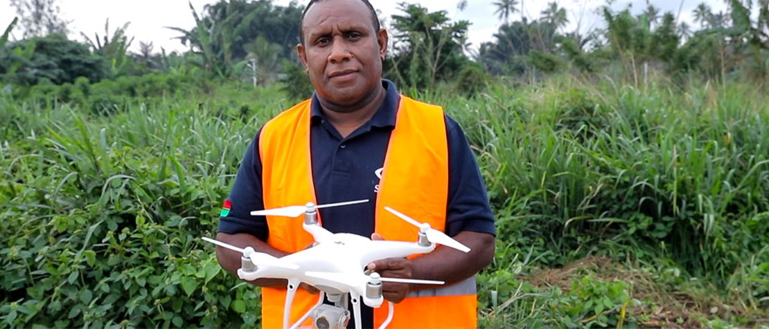
“The sky’s the limit for drones to be used here for an emergency setting,” said Wilson Toa, Director and Country Manager for SkyEye Vanuatu Ltd, a drone company based in Samoa with branches in Vanuatu, the Solomon Islands and Tonga.
The company currently uses drones to provide geographic information system (GIS) footage for 3D mapping surveillance as well as vegetation health maps for coconut trees and farms.
“We would like to see governments within the region embracing the technology and giving opportunities to local companies like us to provide those services,” Toa said. “We understand the context here and we are trying to build in technology that meets the needs of Pacific island nations.”
Opportunities for growth
Back in Vanuatu, the use of drones to meet other specific topographic challenges linked to development is underway.
Related: Samoa Pathway Mid-Term Review: How tech is helping small island countries
For example, right now 20 per cent of children in Vanuatu miss routine vaccinations because villages are so hard to reach; the archipelago spans 1,600km, and many of the 65 inhabited islands are only accessible by boat.
In a world-first, the Ministry of Health and UNICEF launched a pilot project in 2018 to use drones to transport lifesaving vaccinations to children living in remote rural islands.
The government gave commercial contracts to two international drone companies, Swoop Aero and Wingcopter, to deliver temperature-sensitive vaccines to 39 remote villages which would ordinarily take health workers days to access by regular means.
As these new and innovative tools continue to be deployed around the world, they are sure to play an increasingly pivotal role in preventing and limiting human and economic losses in the wake of a disaster.