A satellite view to improve life on Earth

Amy Parker, Director, Centre for Earth Observation (CSIRO), Australia
Did you know that satellites can detect a volcano inflating before it erupts? Or that satellite imagery is being used to understand the impact of the war in Ukraine on global food supply?
At CSIRO, Australia’s national science agency, we are using Earth observation to address the biggest challenges facing society and our planet.
For example, we’ve analysed satellite imagery of Ukrainian cropland and shipping activity since February 2022 to help measure the impact of war on global food supply.
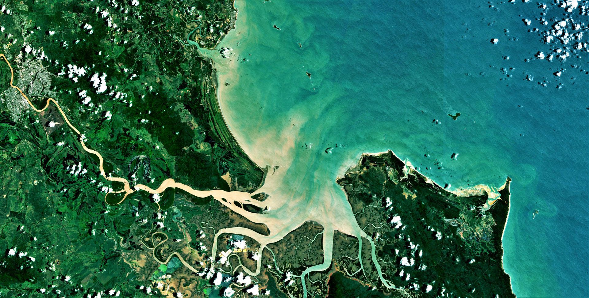
Closer to home, we’re using Earth observation to generate national-scale mineral maps, measure environmental recovery after bushfires, and track the impact of flood sediment on the Great Barrier Reef.
The data challenge
The recent proliferation of open-access Earth-observation imagery is providing unprecedented opportunities and value. The economic benefits attributable to Earth-observation data during 2020 were in the order of AUD 2.5 billion (about USD 1.6 billion) in Australia alone, according to Deloitte. However, exponential increases in the volume and variety of data pose increasing challenges to users, requiring us to change the way that we approach data management and analysis.
To tackle this problem, CSIRO is using cloud computing to provide next-generation Earth observation processing capabilities to our researchers and partners. With Geoscience Australia, Australia’s National Computational Infrastructure, and the Committee on Earth Observation Satellites, we created the “Open Data Cube” — an open-source software for geospatial data management and analysis.
Combining the Open Data Cube with the advantages and innovations of commercial cloud computing, we developed our Earth Analytics Science and Innovation (EASI) platform. This high-performance, scalable data analytics platform benefits from — and contributes back to — the Open Data Cube community, whilst also providing access to CSIRO’s diverse scientific expertise. The technology improves the scale and speed of calculations by large orders of magnitude, promoting a fail-fast (and learn-fast) approach and enabling innovative science.
Sharing the benefits of Earth observation
With EASI, we are striving not only to push the boundaries of science, but to ensure more equal access to the benefits of Earth observation across different regions, tackling issues that span geographic borders. Our proximity to Southeast Asia means we are well placed to work together with our neighbours there, using science to solve problems and sharing computing infrastructure, data, knowledge, expertise, and ideas to address our shared challenges.
For example, we deployed EASI on in-region cloud computing infrastructure in Southeast Asia in 2021 and have since then worked with academics, innovators and scientists from across the region to provide technical training and develop use cases based on climate resilience and adaptation. Early adopters from Hasanuddin University in Indonesia have used the technology to investigate the impacts of climate change on the water quality of Lake Tempe, South Sulawesi.
During a week-long hackathon, over 80 participants from Australia and Southeast Asia tackled applications related to carbon accounting, conservation, water security, and sustainable infrastructure.
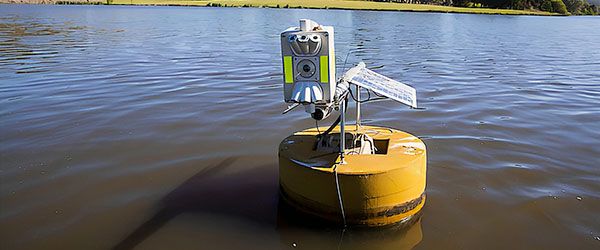
Monitoring water quality from space
Back in Australia, we’re now developing an EASI solution to inform us about our most vital resource — water. We are working with collaborators to co-design and deliver the AquaWatch Australia Mission — “a weather service for water quality” — to help safeguard freshwater and coastal resources in Australia and around the world.
The health and quality of inland and coastal waterways are under threat from increasing human activity and the effects of climate change. This is evident in the growing impacts from drought, bush fire sediment, storm events, toxic algal blooms and contamination.
EASI incorporates Earth-observation data from satellites with in-situ sensors and artificial intelligence (AI), thus creating an integrated system that can deliver accurate monitoring and forecasting across Australia and beyond.
The development, design, build and roll-out of the AquaWatch system infrastructure will benefit diverse end users and directly stimulate growth in Australia’s domestic space capability. It will also drive expertise in remote sensing, advanced manufacturing, and engineering.
Protecting future access
Space presents significant opportunities to improve life on Earth. Taking a satellite view of our planet enables us to manage natural resources, address food-security challenges, respond effectively to disasters, adapt to and mitigate climate change, and optimize transport and urban development.
Protecting the radio frequencies used by Earth-observation sensors and satellites, therefore, is critical. We need to maintain our satellite view, through unhindered access to this valuable data, now and into the future.
Download your copy of the ITU News Magazine: Science services.
Header image credit: Sentinel-2 European Union
Header image caption: Satellite image of sediment flow from the Fitzroy River to the Great Barrier Reef.
Photos credit: CSIRO